There have been multiple accounts created with the sole purpose of posting advertisement posts or replies containing unsolicited advertising.

Accounts which solely post advertisements, or persistently post them may be terminated.

Is land inclination included in area calculation?

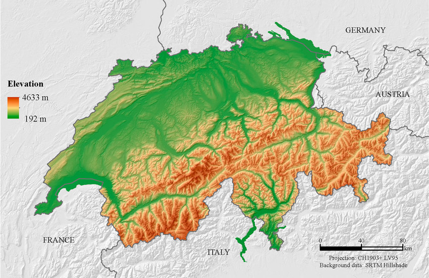
For example on wikipedia for Switzerland it says the country has an area of 41,285 km². Does this take into account that a lot of that area is actually angled at a steep inclination, thus the actual surface area is in effect larger than what you would expect when looking onto a map in satellite view?

ricecake ,

In addition to the other reasons people have given for why they don’t: we’re usually less interested in the surface area of a plot of land than we are in the usable area.

People generally can’t live or farm on a significant slant and will instead level the ground or build supporting structures to make things level.
Things like rainfall are also generally better calculated by flat area.

NeoNachtwaechter ,

People generally can’t live or farm on a significant slant and will instead level the ground or build supporting structures to make things level.

But here we have Switzerland as the example :) where nearly every small or large piece of farmland is far from level.

ricecake ,

“significant” being the keyword. :)

https://sh.itjust.works/pictrs/image/1a9b8aaa-0844-4d21-8f4b-3343db1e49a8.jpeg

There’s clearly a slant, but you can see where it was a bit too much and so they added retaining walls to level things out.

https://sh.itjust.works/pictrs/image/c02de969-a160-4924-8017-6cb44459ef0c.jpeg

In a place like this, you can tell what places are suitable for farming, which could be farmed with a little leveling, which are suitable for grazing, and which are just too steep for food.

They’re definitely not going to entirely level every place, but you also can’t grow food on the side of a mountain. :)

NeoNachtwaechter ,

BTW are the walls of New York’s scyscrapers included in the calculation?

/s

Rhynoplaz ,

Ok, so I know this is just a joke, but you got me thinking.

Each floor of a skyscaper with an area of x² ft, is an additional x² ft of unique space. An acre of skyscrapers, could have 20-30 times more useable square footage than an acre of farmland.

NeoNachtwaechter ,

So, what do you think: has a skyscraper more wall area (including the inner walls) or more floor area (counting all floors)?

Rhynoplaz ,

That’s a fun puzzle like “how many golf balls could you fit in a 747”, but to keep in line with the spirit of the original question, I think floor space is more in line with “is the area of a space more complicated than it’s 2D outline as seen from space” than walls are.

Does that sentence make any sense rereading it? It seems very confusing.

snooggums ,
@snooggums@midwest.social avatar

Inclination must be ignored for area to work on a map, plus the inclination ends up being lost in the noise on a large scale. It is very similar to the coastline issue where the more detail you include the longer the coastline gets until every coastline is basically infinite.

Let’s take an area split into a grid. One are has a hilly round slope, one is flat, and the rest are a variety of combinations. If you tried to take slope into account the one with the round hill would require the straight lines of the grid to warp towards it like one of those space time curvature pictures. The one that is flat is the only one that could be square, and even then it only works if you count it as flat since even flat ground has a small texture.

So no, they don’t take elevation into account for maps because it would be far too difficult to measure.

The surface area can only be calculated with a defined level of accuracy due to how textured surfaces work.

BlackLaZoR ,
@BlackLaZoR@kbin.run avatar

This is the same problem as with coastline length - the higher resolution you'll use, the bigger the number you'll get. AFAIK this is solved by just standarization of calculation methods - there's just certain rounding to be applied in all cases so you get a comparable results

0xb ,

I don’t know the precise answer, but I do know this:

  1. Often the kind of measures that are about something vast and complex (like population for example) are really good approximations, not completely exact numbers. So maybe doesn’t matter because the number itself is not trying to be 100% accurate.
  2. As far as I know those measures are made from the top down view, like with airplanes or satellites, so no it would not include inclines. To include inclines in a precise way it would have to be measured each one on the spot, which is not the way that is done. There are almost no field surveyors these days, again, as far as I know. And to include inclines in an approximate way takes us to point 1 again so it wouldn’t matter much if there were a small difference.
  3. Why would we do that? Almost everything we use land for requires it to be horizontally flat, so we flatten it. For example, an irregular coastline doesn’t matter because we can use the crevices and irregularities to fit in more boats or ports or beaches, since the sea is horizontally flat and that is what really matter to us. But if there’s a hill with a greater area because of the steepness of it we cannot fit more houses or warehouses of streets. We have to flatten it first so we gain noting from it being inclined.

So form my point of view it would be almost as if we tried to include the sides of a ravine or gorge in the measure just because technically it is area space.

Sorry if I cannot give you an exact answer, but I wanted to comment because you raised an interesting point that made me think.

Cheers.

neidu2 ,

Doubt it. Because then it becomes a question at resolution, where too high results in countries with infinite area, since ever slope, ditch, and grain of sand has to be accounted for.

tobogganablaze ,

That also applies to calculating the flat area though.

en.wikipedia.org/wiki/Coastline_paradox

Feathercrown ,

Luckily while the coastline number is affected, the actual area is still bounded. It’s like that infinite horn with paint paradox.

njm1314 ,

It’s not, but I love the idea that it could be. You just know some of those megalomaniac dictators would be piling up fake Hills to make their country bigger. Turkmenistan would have giant Towers of dirt everywhere.

Deestan ,

Due to the fractal nature of geometery, all they would have to do is use more fine-grained measurements. :)

Faresh ,

That would work for the perimeter, but not for the area.

Deestan , (edited )

It works exactly the same!

edit: With the assumption that we now measure inclines of course. If measuring area of the flattened overhead projection (the current normal way) we don’t get fractal effect.

If I go over our parking lot with a 1m^2 granularity, I get 100m^2. If I go with 1cm^2 granularity, I get 110m^2 because I catch the sides of the curbs, potholes, etc.

demonstrations.wolfram.com/3DSnowflakeFractals/

Karyoplasma ,

Fractals are self-replicating while surface area or coastline of a country are inherently finite. You could very accurately measure the surface area, but there’s no reason to do that.

Faresh ,

With the assumption that we now measure inclines of course

I interpreted your reply to njm1314 as meaning “we don’t need to measure inclination to cheat, we can do that by simply increasing our precision”

Deestan ,

I see! Then I understand your response. :)

Faresh ,

deleted_by_author

  • Loading...
  • Feathercrown ,

    If you’re measuring surface area it would.

    sp3tr4l ,

    Lets now measure all coastlines with the minimum increment possible, the planck length.

    ICastFist ,
    @ICastFist@programming.dev avatar

    Do you think the holes left by digging the dirt would also count as increased area? Because it feels like it’d be a 2 for one deal

    OhmsLawn ,

    Absolutely!

    nyankas ,

    There‘s a great video on that topic by Matt Parker (Standupmaths) which I‘d wholeheartedly recommend.

    TLDW: No, terrain elevation isn‘t generally taken into account when calculating a country‘s surface area, though the actual method differs slightly from country to country. Switzerland would be around 7% bigger, if its mountains were to be taken into account.

    not_woody_shaw ,

    I can’t remember if it was Matt Parker or Tom Scott who did a thing about this on youtube, and I think the answer was no, they just use whatever method is easiest to get these numbers, and they’re not even using a consistent methodology from one country to the next.

    r ,
    @r@piefed.social avatar

    It was by Matt Parker. Here it is: https://youtu.be/PtKhbbcc1Rc

    or watch it on piped.video if you prefer: https://piped.video/PtKhbbcc1Rc

    freebee OP ,

    thanks for the links!

  • All
  • Subscribed
  • Moderated
  • Favorites
  • [email protected]
  • random
  • lifeLocal
  • goranko
  • All magazines